History · 6 min read
How the Radcliffe Line Partitioned India and Pakistan
A British bureaucrat who'd never set foot in India drew the borders of two nations in five weeks — then burned his papers and fled. The map he left behind didn't document a conflict. It invented one.
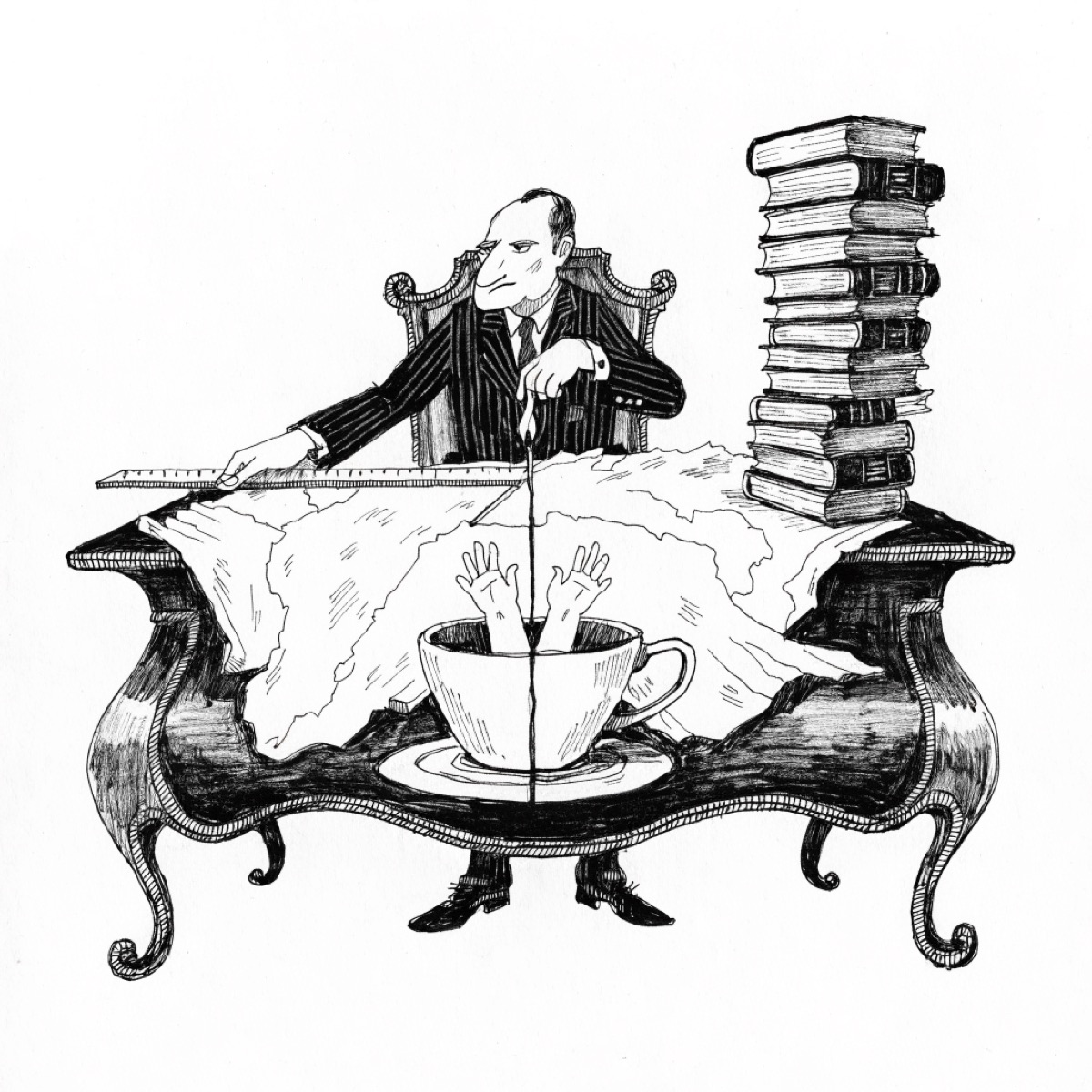
In the summer of 1947, a British civil servant named Cyril Radcliffe stepped off a plane in India for the first time in his life. He had never visited the subcontinent. He spoke none of its languages. Within five weeks, working from colonial surveys and census data in a sweltering Delhi office, he drew a line through the Punjab and Bengal that would define the borders of India and Pakistan. The Partition that followed triggered one of the largest forced migrations in recorded history — 15 million people displaced, up to 2 million dead. Radcliffe reportedly burned his papers afterward and never returned.
It would be easy to read this as a story about British incompetence or imperial arrogance. But that framing misses something more disturbing. Radcliffe didn't stumble into an ancient conflict between two nations and make it worse. He manufactured two nations — and the conflict followed the ink.
Before the Map, There Was No "Here"
For most of human history, territory wasn't something you drew. It was something you experienced — a gradient of familiarity, obligation, and seasonal movement. A medieval peasant living in what is now Bavaria likely understood their world in concentric rings: their village, their lord's estate, the jurisdiction of a distant bishop, and somewhere beyond that, a vague Christendom. "Germany" as a political container would have struck them as an abstraction, possibly a strange joke.
The Ottoman Empire, which controlled much of the Middle East and North Africa for six centuries, offers a particularly instructive alternative. Under the millet system, populations were organized by religious community rather than geography. Christians, Muslims, and Jews lived interspersed in the same streets, governed by different legal codes administered by their own religious authorities. Identity was layered, contextual, and fluid — not pinned to a plot of land on a page.
This isn't romanticism about pre-modern life. It's a recognition that borders as we understand them — linear, fixed, internationally recognized, legally enforced — are a technology. Like writing or coinage, they required invention. And like most technologies, their invention served specific interests.
How Cartographers Became Nation-Builders
The revolution began with Gerardus Mercator's 1569 projection, which for the first time rendered the curved surface of the Earth onto a flat page with consistent, comparable scale. Suddenly, territory could be measured, compared, and — crucially — administered from a distance. Empire, as a logistical enterprise, became possible in a new way. You could tax land you'd never visited, plan military campaigns through terrain you'd never crossed, if you had a reliable map.
The British Great Trigonometrical Survey of India, launched in 1802, captures this logic perfectly. It was framed as scientific curiosity — and it did produce genuine geodetic breakthroughs, including the first accurate measurement of Mount Everest. But its operational purpose was infrastructure for empire: taxation, resource extraction, troop movement, administrative control. To map a place was, in a real and consequential sense, to claim it.
The violence wasn't only in the lines. It was in the labels. Colonial cartographers named what they surveyed, and naming was an act of power. They collapsed hundreds of distinct communities under single administrative categories, imposed racial taxonomies onto fluid social arrangements, and erased local place names in favor of European ones. In Belgian Rwanda, the distinction between Hutu and Tutsi — which had existed as a relatively permeable class distinction, not a rigid ethnic binary — was codified on identity cards and encoded in maps. The map didn't record a reality. It prescribed one. The genocide of 1994 unfolded, in part, along the lines those cards had drawn.
Print, Propaganda, and the Patriot's Imagination
The political theorist Benedict Anderson argued in his landmark 1983 book Imagined Communities that nations are not natural formations but psychological ones — held together not by face-to-face contact but by shared symbols, rituals, and representations. Among those symbols, the standardized map occupies a privileged place.
Consider what a schoolroom map actually does to a child. It shows them a shape — colored, named, bordered — and teaches them that this shape is theirs, that they are responsible for it, that its integrity matters. A child in Calcutta who has never seen the Himalayas nonetheless feels they belong to the same nation as those mountains. A child in Lagos who has never met a Hausa speaker is still taught to think of themselves as Nigerian. The map trains the imagination before politics can fill it in.
Colonial powers understood this instinctively. Wall maps of the British Empire, with its territories colored reassuringly pink, hung in schools from Manchester to Melbourne. French geographic magazines distributed illustrated maps of the empire as cultural artifacts, building in ordinary readers a proprietary feeling about distant territories they would never visit. The map was doing psychological work — manufacturing a sense of collective ownership, collective pride, and, when necessary, collective grievance.
Here is the crucial irony: when anti-colonial independence movements rose up against those same empires, they used the exact same maps. The African National Congress didn't challenge the borders of South Africa — it fought for control within them. Ho Chi Minh's vision of a liberated Vietnam used the colonial cartographic outline as its premise. The tool of conquest became the blueprint of liberation, borders intact. The colonized had been so thoroughly trained in cartographic thinking that they could not imagine freedom except within the shapes their colonizers had drawn.
When the Lines Don't Match the Land
The Berlin Conference of 1884–85 is one of history's most consequential meetings. Representatives of fourteen European nations gathered in Otto von Bismarck's drawing room to divide Africa among themselves. No African leaders were present. The participants worked largely from incomplete maps, drawing borders with rulers across terrain they had never surveyed, through ethnic territories they did not understand, splitting linguistic communities down the middle and locking hostile groups together in the same administrative containers.
Researchers Stelios Michalopoulos and Elias Papaioannou, in a 2011 study published in the Journal of Conflict Resolution, quantified what this meant in human terms. They found that African borders drawn by colonial powers — particularly those that cut across pre-existing ethnic territories rather than following them — were significantly more likely to predict inter-ethnic civil conflict in the post-colonial period. The cartographic violence of the 1880s was still producing measurable bloodshed a century later.
The Sykes-Picot Agreement of 1916 offers an equally clarifying case. In a series of letters between British diplomat Mark Sykes and his French counterpart François Georges-Picot, the modern Middle East was sketched out on a map in London and Paris. Lebanon, Syria, Iraq, Jordan — these were administrative conveniences, not organic nations. Populations who had lived for centuries in Ottoman provinces, with overlapping religious and tribal identities that resisted any clean categorization, were suddenly assigned to nation-states they hadn't chosen and couldn't have imagined. The consequences have not finished unfolding.
The Map's Afterlife
None of this means borders are without value. The alternative — a world of fluid, contested territories with no agreed-upon lines — is not obviously more peaceful. Fixed borders, whatever their origins, provide a framework for international law, diplomatic negotiation, and the projection of rights. The problem is not that borders exist. The problem is the story we tell about them.
When we treat a border as natural — as an expression of something deep and ancient in a people — we make it sacred, and sacred things cannot be compromised. The line Radcliffe drew in five weeks becomes, a generation later, a civilizational boundary worth dying for. The racial category a Belgian administrator assigned becomes, decades on, an identity so total it can motivate mass killing. The map's most dangerous trick is not that it invents these things. It's that it makes the invention invisible.
Radcliffe burned his papers, perhaps out of guilt, perhaps out of self-protection. But the map survived. It always does. And maps, unlike their makers, never express doubt about what they've done.
The most powerful political documents in history are not constitutions or treaties. They are the maps that precede them — the ones that decide, before any vote is cast or argument made, who is "us" and who is "them," where the story begins and where the stranger starts.